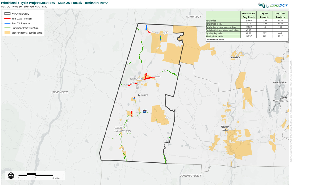
To advance the vision of its Beyond Mobility: 2050 Transportation Plan, the Massachusetts Department of Transportation (MassDOT) is focused on expanding its network of high-comfort pedestrian and bicycle facilities for short trips throughout the Commonwealth. To support this effort, VHB used a data-driven approach to develop the Next Generation Bicycle and Pedestrian Vision Map, which identified and prioritized mid- and long-term multimodal investments along MassDOT roadways within the 13 planning regions across the Commonwealth.
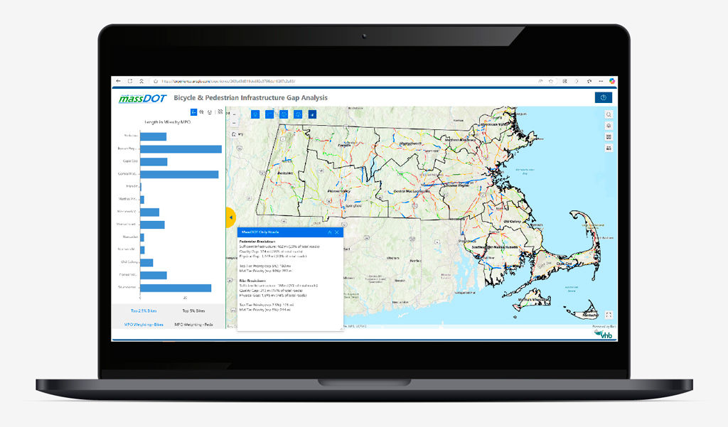
The project used open-source GIS assets along with other big data platforms such as INRIX to support the analysis and prioritization process. The study involved several main components:
- Establishing the ‘Recommended Infrastructure’ for pedestrians and bicyclists on the study area road network
- Identifying physical and quality gaps in existing bicycle and pedestrian infrastructure
- Creating a ‘Vision Map’ where 100% of residents living or working along applicable roadway segments have access to high comfort pedestrian and bicycle facilities for short walking and biking trips
- Prioritizing and grouping gap segments into mid- and long-term projects
The results of this analysis provide MassDOT with a roadmap of recommended pedestrian and bicycle infrastructure projects for the foreseeable future.